Summer in Iowa brings heat, humidity, and road trips. Iowans travel long distances to visit relatives, try a new burger joint, watch a ballgame, or attend a county fair. Road tripping is big in our state, and it can also be an adventure if one chooses to go on the back roads, or as my family calls them, the Bingo roads.
Bingo roads sound like the squares on a Bingo card – D-46, M-27, B-50. They run north and south, east and west, all across Iowa. I have driven on many of them and learned a few things along the way. In June, for example, I made one of my many trips from Okoboji to Denison the visit relatives.
A Google map search will direct you on #71 most of the way. Being an Iowa native, I know better than Google that there’s a shorter route via the Bingo roads – shorter, quicker, and with less traffic. However, that day I decided to take state highway #71 to avoid well-publicized road construction on #20 near Galva. Big mistake.
I was cruising along fine until south of Sioux Rapids where I saw one of those dreaded ‘Detour’ signs. Even worse, it was a detour sign with an arrow pointing east and Denison was southwest. I knew I would encounter a delay in my arrival time and had to make a split-second decision because of cars behind me. I could go as directed, traveling east on an alternate hard-surfaced road. Or, I could turn west into unknown territory on gravel.
I’ve made that second choice – gravel – a few times, and it usually ended in disaster. For one thing, as every Iowan worth their salt knows, driving on even a quarter-mile of an unsurfaced road will coat your car with dirt and dust. This choice would also slow me down because all Iowa drivers know how to drop their speed to under 50 mph on gravel rather than risk sliding into the ditch. Even more troublesome was the fact that Iowa’s gravel roads tend to do funky things.
For example, they may look like they are heading west, when all of a sudden there’s a curve in the road and you’re heading north. Or, you may unexpectedly come to a T-intersection and must choose north or south, neither of which is in the direction of your destination. I’ve encountered rivers, woods, farm places, and packs of large, overly-protective, and agitated guard dogs at the end of what I thought were public roadways but were actually long private lanes.
Considering all the pitfalls of driving on gravel, I chose to obey the detour sign and head east on #10, certainly out of my way, but most likely safer. A glance at the map – a real, tangible, paper map – I saw that Bingo road, M-50, was only a couple of miles east. Maybe this detour wouldn’t be so bad, after all. Or maybe not. As I slowed down to turn south on M-50, I saw another, more sinister, road construction sign: Bridge Out; Road Closed.
At this point, I had no choice but to continue on #10 to the next Bingo road, M-54 south of Marathon. This would be eight miles out of my way! Add another eight miles for the return to #71 and that made sixteen miles of driving out of my way because of a detour. I could have taken another shortcut on gravel, but I was still leery because I knew from experience that unsurfaced roads in that area can end unexpectedly at the river, or even change suddenly from gravel to dirt.
I had no choice but taking M-54 south a few miles, and then heading back west on C-25 to hook up with #71 again near Rembrandt. Eventually, I made it to Denison a few minutes late meeting my cousins for lunch at Cronk’s.
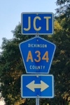
Returning home, I decided to avoid the Sioux Rapids debacle and take my usual shortcut home, going north on #59 to Ida Grove and staying on Bingo roads the rest of the way. I was still concerned about a possible delay near Galva because of road construction on the #20 four-lane, but Bingo road M-25 crossed #20 into town, and a detour sign simply directed traffic east on another Bingo road, D-15. In a couple of miles, I was able to continue my trip my usual back roads – the trusted Bingo roads I often take home: M-34, A-22, M-27, and A-34 right to the end of my lane. Bingo!

I laughed so hard. I have a terrible time with east & west & north & south. I would have ended up in Minn.
LikeLike
This would be the very reason I don’t drive very far any more. I am much safer at home with Max.
LikeLike
Les always uses the “Bingo” roads!! We have seen lots of the country that way!! Good Blog!!
LikeLike
Really enjoyed this article, Thanks for sharing some of your fun times. I’m not sure what you would call Missouri’s roads, bingo and double bingo roads?
LikeLike
Delightful piece. I had not heard that term for the roads until I heard it from Bonnie. I will call them Bingo Roads from now on.
LikeLike
What a delightful piece!. Made me dizzy trying to picture this in my mind! Thoroughly enjoyed it!!
LikeLike
I will never forget our trip down M27 on our way to C65 with Sioux City being our destination. It was a foggy morning and we’d not driven that route for a while. All of a sudden we seemed to be driving into the midst of an army of humongous robots. A wind farm had been erected during our long absence and it looked very eerie the eatlh morning fog. Thanks for teaching me the new name for what I’ve been calling county roads.
LikeLike